
Rota Vicentina: Fishermen's Trail or Historical Way, A Hiker's Guide
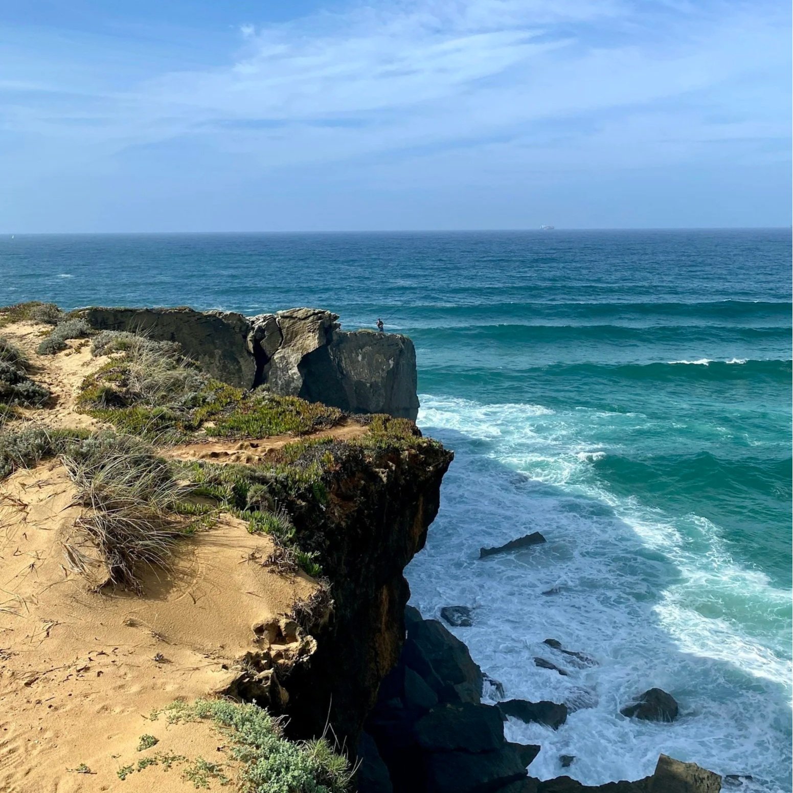
Here's something we didn't expect the first time we walked out of Vila Nova de Milfontes toward Almograve: the trail wasn't built for us. It was never meant to be scenic. Fishermen carved these exact paths into the cliffs generations ago, leaving before dawn with their gear to reach the best fishing spots, walking home again at sunset, day after day, for longer than anyone bothered to write down. You're not hiking a trail that was designed. You're walking someone else's old commute, and it happens to be one of the most beautiful walks in Europe.
That's the thing about the Rota Vicentina that most guides skip past. It isn't a manufactured tourist trail with a marketing department behind it. It's real, working, centuries-old paths that a local non-profit spent years mapping, waymarking, and stitching together — officially launched in 2012, specifically to protect this coastline while keeping small guesthouses and family restaurants in business. Whether you walk one stage or all thirteen, you're following the same ground fishermen have walked for generations, and that changes how it feels underfoot.
Two Trails, One Network with Genuinely Different Experiences
The Rota Vicentina isn't a single path. It's two parallel routes that occasionally cross, and picking the right one for your day matters.
| Fishermen's Trail (Trilho dos Pescadores) | Historical Way (Caminho Histórico) | |
|---|---|---|
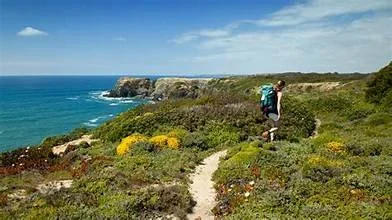
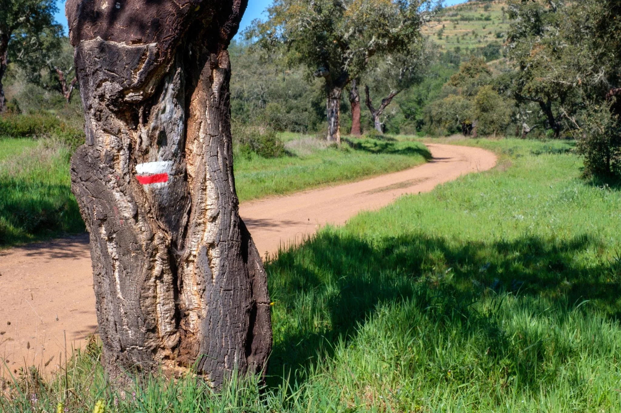
| Terrain | Coastal cliffs, sand, dunes — single-track, right along the edge | Inland dirt roads and farm tracks through cork-oak countryside |
| Difficulty | More demanding — sand saps your energy faster than it looks like it should | Easier, more consistent footing |
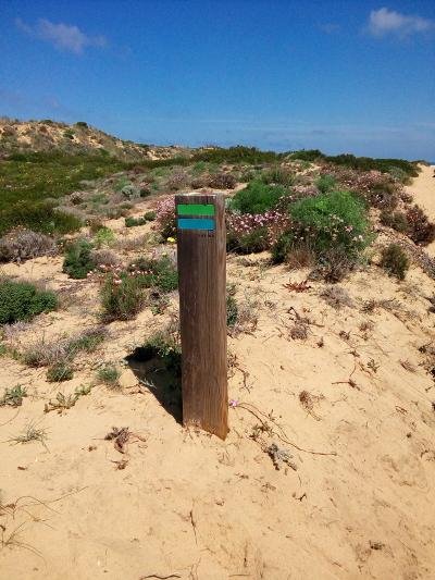
| Trail markers | Blue and green | Red and white |
| Total length | 226 km, in 13 one-day stages (extended from the original 4 in 2020) | Runs from Santiago do Cacém to Odeceixe before joining the coast |
| The draw | Dramatic, ocean-facing, the classic postcard version | Quieter, greener, a genuinely different side of the region |
Here's a detail almost nobody mentions: the two trails were founded a year apart. The broader Rota Vicentina network came together in 2012; the Fishermen's Trail specifically was only formalized in 2013, starting as a modest four-stage route between Porto Covo and Odeceixe. It's grown a lot since. By 2016, the European Commission had named it one of Europe's Leading Destinations, which is a fairly serious accolade for a trail that, less than a decade earlier, barely had a name.
Book it: Fishermen's Trail - Costa Alentejana, guided trail (Porto Cova)
The Storks That Shouldn't Exist Here
We're going to slow down on this one, because it's the single most interesting fact about this whole coastline and most people walk right past it without knowing what they're looking at.
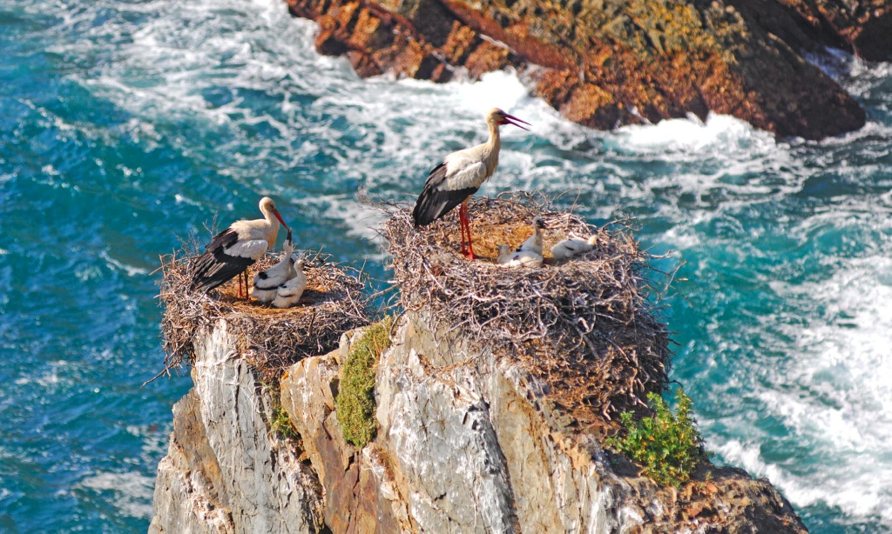
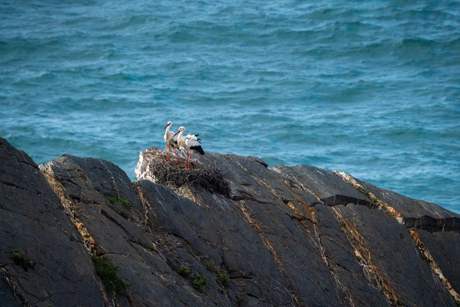
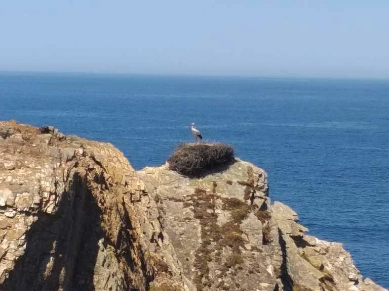
Somewhere between Cabo Sardão and Entrada da Barca, south of Milfontes, on the Fishermen's Trail, you'll pass sea stacks with what look like enormous tangled nests balanced right on top of the rock, exposed to open ocean wind on every side. Those are white stork nests. Over 40 of them, occupied every spring. And here's the part that stops most hikers in their tracks once they understand it: this is the only place on Earth where white storks nest directly on sea cliffs. Everywhere else in the world, storks build inland (church towers, chimneys, tall trees, pylons). Only here, on this specific stretch of Portuguese coast, have they adapted to raise their young in one of the most exposed, wind-battered positions imaginable, with nothing between the nest and the Atlantic swell below.
Nobody fully agrees on why. The leading theory is simply that the cliffs offer total protection from ground predators, and the storks decided the trade-off, brutal spring winds in exchange for total safety, was worth it. Whatever the reason, you're looking at a genuinely singular piece of natural behavior, found nowhere else on the planet, and it happens to sit right on a trail you can walk yourself.
Which Stage Should You Actually Walk From Milfontes?
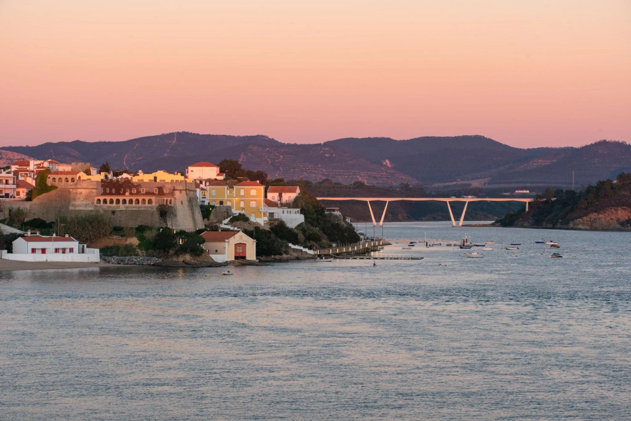
If you followed our Milfontes guide, this is the natural next-day hike: Milfontes to Almograve, the trail's official starting stage heading south. It runs roughly 15 km and takes most hikers somewhere between 4 and 5.5 hours, depending on pace and how many times you stop to take in the view. The route crosses the Milfontes bridge, follows the riverbank out past Praia das Furnas, and then continues along the coastline — sand, dunes, and increasingly dramatic cliffs the further south you go.
A seasonal boat crossing of the Mira, when it's running, can shave a few kilometers off the start by skipping the bridge loop entirely. It’s worth asking about locally if you want the shorter version.
If a full day of sand-heavy coastal walking doesn't sound like your idea of a good time, the Historical Way runs a parallel, easier route through farmland on this same stretch. It’s different scenery, same general direction, but considerably kinder on your legs.
Practical Things Nobody Tells You Until You're Already Out There
A few honest, unglamorous logistics worth knowing before you lace up:
Sand is deceptively tiring. A 15 km stage on sand will feel harder than a 15 km stage on a normal trail. Budget more time and energy than the distance alone suggests.
The cliffs are actively eroding. Sections of the path sit genuinely close to crumbling edges. Stay on the marked route, especially near cliff tops.
Best season is September through June. Locals generally avoid recommending the trail in peak July–August heat; the shoulder seasons bring cooler temperatures and considerably fewer other hikers.
Luggage transfer is a real, common service here, Several local operators will move your bag between overnight stops so you can walk with just a day pack, which makes multi-day stretches far more comfortable.
You're crossing private land in places. Much of the trail runs through a mix of public and private paths, walked under an informal local agreement. Stay on the marked route as a matter of respect, not just navigation.
If You Keep Going: The Trail's Real End Point
Our itinerary stops at Odeceixe, but the Rota Vicentina itself keeps going, all the way to Cabo de São Vicente, the literal southwestern tip of mainland Europe. The Romans called it Promontorium Sacrum, the Sacred Promontory, and believed it was where the known world simply ended. There's a good story attached to the name: legend says the relics of a 4th-century martyr, Saint Vincent, washed ashore here guarded by ravens, and when King Afonso Henriques later had the relics moved to Lisbon by boat, two ravens are said to have escorted the ship the entire way, which is why, to this day, Lisbon's coat of arms shows a ship flanked by two ravens. It's not a detour most people on a 7-day itinerary have time for, but it's worth knowing the ending exists.
Fishermen's Trail or Historical Way: Which Is Right for You?
Choose the Fishermen's Trail if: you want the postcard version with dramatic cliffs, constant ocean views, sand underfoot, and you're comfortable with a physically demanding day. This is the one worth prioritizing if you only have time for one.
Choose the Historical Way if: you're traveling with kids, prefer easier and more consistent terrain, or simply want a quieter, greener side of the Alentejo that most visitors never see. It's the better fit for families following the rest of our itinerary in its family-friendly form.
Both trails are well-marked, walkable in either direction, and open year-round.
Where to Stay for Your Hiking Days
Milfontes makes the ideal base for the Milfontes–Almograve stage, you can walk out and either loop back or arrange a transfer. Full accommodation options, with distances to the trailhead, are in our Where to Stay on the Vicentine Coast guide.
FAQ
What's the difference between the Fishermen's Trail and the Historical Way? The Fishermen's Trail hugs the Atlantic coastline over sand and cliffs and is physically demanding; the Historical Way runs inland through cork-oak farmland and is easier, more consistent terrain. Both are part of the same Rota Vicentina network and can be walked in either direction.
How long is the Fishermen's Trail? The full network runs about 226 km across 13 one-day stages, though most visitors walk just one or two stages rather than the entire route.
Is the Rota Vicentina safe for solo hikers? Yes, the trail is well-marked and popular enough that you're rarely far from other hikers or a village, though the usual cliff-edge and weather precautions apply, and it's worth telling someone your planned route for any longer stage.
What's the best time of year to hike it? September through June, according to local guidance, the trail is generally not recommended during the peak July–August heat, and the shoulder seasons offer cooler temperatures and fewer crowds.
Do I need to book a guide, or can I hike it independently? Both are common. The trail is well-marked enough for independent hikers, and luggage transfer services make multi-day independent hiking genuinely comfortable. A guided option is worth it mainly if you want the storytelling and local context along the way.
Part of our Vicentine Coast series: The full itinerary · Arrábida & Setúbal · Sines, Porto Covo & Ilha do Pessegueiro · Vila Nova de Milfontes · Zambujeira do Mar to Odeceixe · Where to Stay on the Vicentine Coast